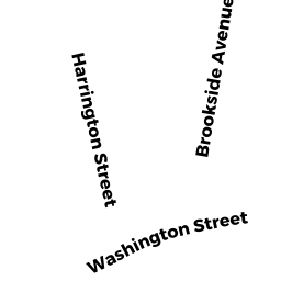
1077-1079 WASHINGTON ST
Owner Information
ROBINSON ROSINA M & ROBERT J
1077 1079 WASHINGTON ST
WEST NEWTON, MA 02465


Property Details
1077-1079 WASHINGTON ST is classified as a Two-Family Residential (Two family).
The primary structure on this property was built in 1880. There are 4,797ft2 of built area within this property. There is 2,378ft2 of residential/living space within this property. This property is listed as having 12 rooms.
1077-1079 WASHINGTON ST is valued at $698,700. The land is valued at $445,800 and the structures are valued at $252,900.
This property is in Zone BU2. Confirm with local Zoning Board authorities to ensure there are no overlays or other easements on this property.
The most recent deed for 1077-1079 WASHINGTON ST is recorded at the local registrar in Book 31580, Page 244. 1077-1079 WASHINGTON ST was last sold on Thursday, June 1, 2000 for $343,000.
Assessment data from fiscal year 2022.
Flood Data
According to the FEMA National Flood Hazard Layer, this property does not appear to be in a flood zone. It may also be in an area not yet reviewed. Nonetheless, confirm this information prior to taking any action.
To view the flood hazards around this property, create a FEMA "Firmette" Map of the area around 1077-1079 WASHINGTON ST.
Broadband Internet Providers
| Provider | Type | Bandwidth (mbps) | |
|---|---|---|---|
| Viasat Inc | Satellite | 100 | 3 |
| HughesNet | Satellite | 25 | 3 |
| VSAT Systems, LLC. | Satellite | 2 | 1 |
| GCI Communication Corp. | Satellite | 0 | 0 |
| RCN | Fiber | 1000 | 20 |
| RCN | Cable | 1000 | 20 |
| RCN | Cable | 500 | 20 |
| RCN | Cable | 25 | 4 |
| Comcast | Cable | 1000 | 35 |
| Verizon New England Inc. | Fiber | 940 | 880 |
| Verizon New England Inc. | DSL | 7 | 0 |
Broadband service provider data from December 2020.
Adjacent Properties
- 1081 WASHINGTON ST
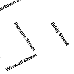
Small Retail and Services stores (under 10,000 sq. ft.) owned by COXALL HAROLD C JR - 57-59 PARSONS ST #57
Residential Condominium owned by MANGADA MALOY & KRISTIN - 57-59 PARSONS ST #59
Residential Condominium owned by ORILLA GEMMA & WINSTON - 57-59 PARSONS ST
Other, Open Space owned by 57-59 PARSONS ST MASTER DEED